
Occurrence record: NSW569772
Preserved specimen
of
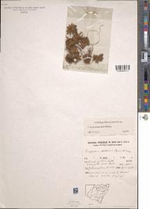
Pappochroma setosum
(Benth.) G.L.Nesom
recorded on 1976-01-27
Images
Dataset
| Data partner | Australia's Virtual Herbarium |
| Data resource | NSW AVH feed |
| Institution code |
The Royal Botanic Gardens & Domain Trust
Supplied institution code "NSW" |
| Collection |
National Herbarium of New South Wales
Supplied collection code "NSW" |
| Catalog number | NSW569772 |
| Occurrence ID | NSW:NSW:NSW569772 |
| Record type |
Preserved specimen
Supplied basis "PreservedSpecimen" |
| Preparations | sheet |
| Identified by | Cherry, W.A. |
| Collector |
Thompson, J.
Supplied as "Thompson, J." |
| Record number | 544 |
| Reproductive condition | fertile |
| Associated Occurrence Status | Asserted duplicates |
| Associated occurrences |
The occurrence is associated with a representative record.
For more information see Inferred associated occurrence details |
| License | CC-BY 4.0 (Int) |
| Establishment means | native |
| Type | PhysicalObject |
| Presence/Absence | PRESENT Supplied as present |
| Associated records | ASSOCIATED |
| Disposition | in collection |
| Occurrence remarks | Scattered. |
| Date identified | 2001-08 |
Event
| Occurrence date | 1976-01-27 |
| Date precision | DAY |
Taxonomy
| Higher classification | (Benth.) M.Gray |
| Scientific name |
Pappochroma setosum
Supplied scientific name "Erigeron setosus (Benth.) M.Gray" |
| Identified to rank | species |
| Kingdom | Plantae |
| Phylum | Charophyta |
| Class | Equisetopsida |
| Order | Asterales |
| Family | Asteraceae |
| Genus |
Pappochroma
Supplied as "Erigeron" |
| Species | Pappochroma setosum |
| Name match metric | exactMatch |
| Scientific name authorship | (Benth.) G.L.Nesom |
| Name parse type | SCIENTIFIC |
| Nomenclatural code | ICN |
| Verbatim taxon rank | species |
Geospatial
| Country | Australia |
| State or Territory | New South Wales |
| Locality | Head of Blue Lake, Kosciuszko National Park. |
| Habitat |
Supplied as "In mat of small plants mostly Plantago." |
| Latitude |
-36.4 Supplied as: "-36.40" |
| Longitude |
148.32 Supplied as: "148.32" |
| Datum | EPSG:4326 |
| Verbatim coordinate system | Degrees Minutes |
| Coordinate precision | Unknown |
| Coordinate uncertainty (in metres) | 25000.0 |
| Georeference sources | Gazetteer |
| County | Southern Tablelands |
| Terrestrial | true |
| Verbatim latitude | 36 24 S |
| Biome | TERRESTRIAL |
| Marine | false |
| Country Code | AU |
| Verbatim longitude | 148 19 E |
| Verbatim coordinates | 36 24 S, 148 19 E |
Data quality tests
| Test name | Result |
| First of the year | Warning |
| Geodetic datum assumed WGS84 | Warning |
| Show/Hide 95 passed properties | |
| Show/Hide 5 missing properties | |
| Show/Hide 22 tests that have not been run | |
Inferred associated occurrence details
This record is associated with the representative record. This mean another record has been detected to be similar to this record, and that the other record (the representative record) has the most detailed information for the occurrence. More information about the duplication detection methods and terminology in use is available here:
| Representative Record | |||
| Record UUID | 5cc02a83-4306-4fb8-9280-454d30025f7d | ||
| Data Resource | |||
| Raw Scientific Name | Erigeron setosus | ||
| Coordinates | -36.398454,148.317906 | ||
| Related records | |||
| Record UUID | 6e7242a4-01be-47cb-a724-0cb04762914e | ||
| Data Resource | |||
| Raw Scientific Name | Erigeron setosus | ||
| Coordinates | -36.398446,148.317935 | ||
| Record UUID | 33033c98-a529-4945-8382-61c807de693a | ||
| Data Resource | NSW AVH feed | ||
| Raw Scientific Name | Erigeron setosus (Benth.) M.Gray | ||
| Coordinates | -36.4,148.32 | ||

